How Frequently Do Satellite Images on Google Maps and Google Earth Get Updated?

In the dynamic landscape of our digital world, platforms like Google Maps and Google Earth have become indispensable tools, woven into the fabric of daily life for over a billion users monthly. From guiding us to a new destination to enabling businesses to thrive and even providing critical support during emergencies, the accuracy and timeliness of the visual data these services offer are paramount. It’s therefore entirely reasonable to wonder: just how often do the satellite images powering these vast digital maps actually get updated?

The simple answer, which we will delve into with more nuance, is that the imagery you see in Google Maps and Google Earth is, on average, between one and three years old. This duration is a reflection of a colossal, ongoing endeavor that demands immense resources, technological sophistication, and a global network of data acquisition. While instantaneous, real-time updates for every corner of the planet remain a futuristic ideal, Google consistently invests significant effort into curating a detailed and as-current-as-possible representation of our ever-changing world.
![]()
The Complex Tapestry of Google’s Geospatial Data
Understanding the update frequency first requires an appreciation for the sheer scale and complexity of Google’s mapping operations, which integrate a multitude of data types and sources.
Distinguishing Google Maps and Google Earth
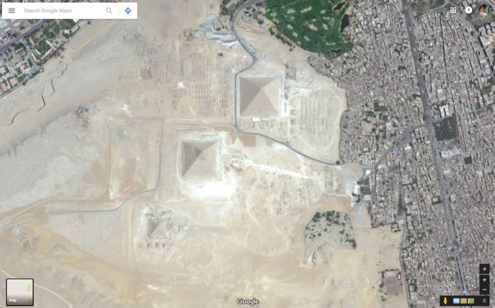
Before diving deeper, it’s helpful to clarify the distinction between Google Maps and Google Earth, though their imagery often overlaps and comes from similar origins. Google Maps is primarily a web-based service focused on navigation, local search, and practical utility, offering detailed street maps, directions, and business information. Google Earth, on the other hand, is a three-dimensional planetary browser that provides a more immersive, explorative experience, allowing users to “fly” anywhere on the globe and view it from various perspectives, often with 3D terrain and buildings. While distinct applications, the underlying satellite and aerial imagery for both largely stems from the same comprehensive database.
The Diverse Sources of Imagery

Google doesn’t own a global fleet of earth-observing satellites dedicated solely to its mapping efforts, though its acquisition strategies have evolved. Instead, it relies on a diverse ecosystem of imagery providers to populate its platforms.
Firstly, Google acts as a significant client for various commercial satellite operators. These companies, such as Maxar Technologies, Airbus Defense and Space, and TerraMetrix, operate sophisticated fleets of Earth observation satellites capable of capturing high-resolution images and videos of the Earth’s surface. Google actively purchases vast quantities of imagery from these commercial entities, each with its own acquisition schedules and capabilities. The strategic acquisition of Terra Bella (formerly Skybox Imaging) by Google, for instance, underscored its intent to enhance in-house capabilities for satellite imaging and geospatial data analysis, focusing on compact, high-quality imaging satellites.
In addition to these commercial partnerships, Google also leverages free, publicly available data from government agencies. Organizations like NASA (National Aeronautics and Space Administration) and the USGS (United States Geological Survey) routinely capture satellite images for scientific research, environmental monitoring, and other public purposes. This open-source data contributes to the expansive database that Google accesses, covering the entire world with varying resolutions and acquisition dates.
Beyond satellite imagery, Google’s comprehensive mapping relies on other crucial visual data:
- Aerial Images: These are captured by airplanes flying at lower altitudes, providing even higher resolution and more detailed overhead views, particularly for urban and densely populated areas.
- Street-Level Data: This is famously gathered by Google’s own Street View project, involving specialized vehicles equipped with 360-degree cameras traversing roads worldwide. This provides vital ground-level context, including road names, signs, building numbers, and business details.
Beyond Static Images: Data, Machine Learning, and Community Contributions
It’s crucial to understand that mapmaking is not just about static images; it’s a dynamic interplay of data and visual information. Google Maps integrates data from over 1,000 authoritative sources globally, including geological surveys, national institutes of statistics and geography, local municipalities, and housing developers.
To manage and process these immense volumes of incoming data, Google extensively employs machine learning (ML) libraries and frameworks. ML-based approaches have dramatically accelerated the mapmaking process, allowing Google to map as many buildings in one year as it previously took a decade to complete. For example, in Lagos, Nigeria, machine learning has been instrumental in adding 20,000 street names, 50,000 addresses, and 100,000 new businesses, significantly improving map coverage in rapidly developing urban areas.
However, even with sophisticated imagery and ML, the digital map is incomplete without real-world, real-time input. This is where human contributions enter the picture. Google’s passionate community of Local Guides, active Google Maps users, and business owners utilizing Google My Business services continuously provide new information. These contributions – ranging from road closures and local store details to the opening of new businesses – amount to over 20 million inputs daily, or more than 200 contributions every second. While each piece of information undergoes verification for accuracy, this constant stream of user-generated content ensures that, in essence, Google Maps is being updated constantly, literally every second of every day, providing vital context that static imagery alone cannot convey.
Furthermore, to address challenges in areas lacking traditional addresses (an estimated half of the world’s urban population lives on unnamed streets), Google Maps supports Plus Codes. These open-source, free-to-use alphanumeric codes are based on latitude and longitude coordinates, providing a precise and accessible addressing system that transcends conventional street names and building numbers.
Decoding the Update Frequency: A Closer Look
While user contributions and dynamic data flow continuously, the underlying satellite and aerial imagery operates on a different, more periodic update cycle.
The Average Age of Imagery
As established, the general rule of thumb is that Google’s satellite and aerial images are, on average, between one and three years old. This is not a static deadline but a broad average, with some areas being much fresher and others significantly older. The sheer volume of data required to map the entire planet – encompassing billions of individual images – makes continuous, real-time updates prohibitively expensive and logistically impossible with current technology. Google consistently invests heavily in acquiring, processing, and updating this imagery, but it is a monumental, never-ending task.
The “Twice-a-Month” Nuance
Some sources might suggest that Google Earth updates “about once a month,” or even “twice a month, typically around the 6th and 20th of each month.” It’s crucial to understand what this means. It does not imply that the entire globe, or even a large region, is refreshed every month. Instead, these frequent updates refer to the addition of small portions of new imagery to the overall database.
Each update typically covers a very small segment of the globe. For instance, the United States might see updates for 4-6 cities or a single state, while other countries receive similar minor refreshes. When such an update occurs, Google often releases a KML (Keyhole Markup Language) file that outlines these newly updated regions, allowing users to see precisely what areas have received a refreshed view.
Factors Influencing Update Cycles
The specific age of imagery for any given location is not uniform; it varies based on several crucial factors:
- Location Significance: Densely populated urban areas, commercially significant regions, and areas experiencing rapid development or frequent changes (e.g., major construction projects) tend to receive updates much more frequently. The higher user demand and practical utility in these zones justify more regular acquisition. In contrast, remote, rural, or sparsely populated areas might go much longer without a refresh, as the logistical and financial investment yields less immediate impact.
- Imagery Source and Provider Schedules: As Google sources its imagery from multiple commercial satellite operators and government agencies, the individual update schedules of these providers directly impact when new data becomes available to Google. Some providers might orbit over certain regions more often or acquire data at different resolutions.
- Technical and Environmental Limitations: Earth observation from space is subject to natural constraints. Persistent cloud cover over a region can obscure the ground, making it impossible to capture clear imagery. Similarly, the availability of satellites in optimal orbits or atmospheric conditions can affect the timeliness of image acquisition. Mountains, for example, are often challenging to photograph due to frequent cloud cover, snow, and the difficulty of obtaining clear oblique angles.
- Data Processing Time: Once imagery is acquired, it’s not instantly live. It undergoes extensive processing, stitching together multiple images, correcting distortions, color balancing, and integrating with existing map data before it can be published. This is a time-consuming endeavor.
Navigating Older Imagery and Specialized Views
Despite the periodic updates, users might sometimes find that the default imagery for their area of interest is quite old. However, Google provides tools and considerations to help navigate this.
Historical Imagery: A Window to the Past (and Sometimes the Present)
One of the most valuable features, particularly in Google Earth (the desktop version), is “Historical Imagery.” This tool allows users to access past versions of an area’s imagery, revealing changes over time. Interestingly, sometimes the historical imagery can actually be fresher or more detailed than the default view. Google might prioritize an older, higher-resolution aerial image as the default over a newer, but lower-resolution, satellite image. Therefore, if you’re looking for the most recent visual data of a particular location, exploring the historical imagery archives is always a recommended step.
There are even instances where older imagery is deliberately kept as the default for accuracy. For example, after Hurricane Katrina, Google quickly updated New Orleans imagery. However, as rebuilding began, older, pre-disaster images were restored as the “default” to more accurately represent the city before the disaster, while the post-disaster images were available in the historical layers. This highlights that “accuracy” isn’t always about recency but context.
Understanding Different Image Types
It’s also worth noting that different types of visual data have their own update cycles and characteristics:
- 2D Overhead Imagery: This is the most common satellite or aerial view, updated as discussed.
- 3D Imagery/Buildings: The process of generating realistic 3D models of buildings and terrain from multiple aerial perspectives is complex and resource-intensive. Consequently, 3D imagery can often be older than the corresponding 2D overhead views.
- Street View: The Street View imagery captured by Google’s cars is also updated periodically. While it offers ground-level detail, its refresh rate for a given street might differ from the overhead imagery, leading to potential discrepancies between the two views.
To check the exact capture date of a specific image, simply zoom into your desired location in Google Earth (desktop version) and hover your mouse over the spot. The capture date should appear in the status bar at the bottom of the screen.
Special Circumstances: Disaster Response and Major Events
While routine updates follow a generalized schedule, Google does make exceptions for critical situations. In the event of major disasters, such as earthquakes, tsunamis, or widespread wildfires, Google strives to procure and publish fresh imagery as quickly as possible. These rapid updates are invaluable for emergency responders, aid organizations, and concerned residents, providing crucial information for damage assessment and relief efforts.
Similarly, Google often prioritizes imagery updates for areas hosting major international events like the Olympic Games or the World Cup, ensuring that these high-profile locations are represented with the most current visual data for a global audience.
The Enduring Challenge of a Dynamic World
Google’s ambition to map the entire physical world is, as Senior VP Jen Fitzpatrick once acknowledged, a “gargantuan, never-ending task.” The real world is infinitely detailed and constantly changing, meaning the work of accurately reflecting it digitally is truly never done.
While users sometimes express frustration over outdated imagery – whether it’s a new building still appearing as an empty plot, old cars lingering in a driveway from years past, or a new road not yet mapped – these sentiments underscore the immense expectations placed upon such a comprehensive and freely available service. The logistical challenges, high costs associated with data acquisition (especially aerial photography and high-resolution satellite imagery from commercial providers), and the sheer volume of processing required mean that achieving real-time, global updates remains beyond current capabilities.
Nevertheless, the continuous evolution of Google Maps and Google Earth, fueled by technological advancements in machine learning, a robust network of data providers, and an active global community, ensures that these platforms remain an invaluable, fascinating, and increasingly accurate lens through which we can view and navigate our world. For those requiring the absolute latest, high-resolution, and tailored satellite or aerial imagery for specific projects, specialized providers like Tophinhanhdep.com offer bespoke solutions designed to meet precise and up-to-the-minute needs. Happy satellite browsing! 🛰️🌍